Strava has rolled out a new set of hiking features to make the app more useful before, during, and after a walk.
The update is said to make hiking more discoverable, navigable and social on the platform, and includes route planning, trail navigation and post-activity sharing tools.
The brand says hiking clubs grew 5.8 times last year, according to its 2025 Year In Sport report, suggesting more people are treating walking and hiking as social activities.
The update includes features for free Strava members, although some of the more advanced tools remain locked behind a subscription.
More reasons to open Strava before a hike
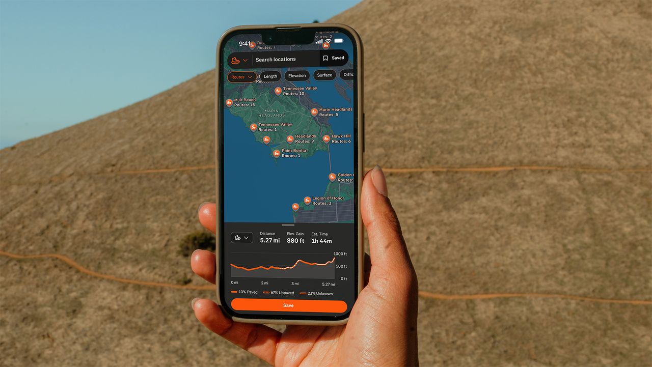
Strava says it is improving its map experience with richer trail-surface data and clearer points of interest, including trailheads, picnic areas, and campgrounds.
These map style improvements are due to roll out later this summer and should make dense trail networks easier to understand at a glance.
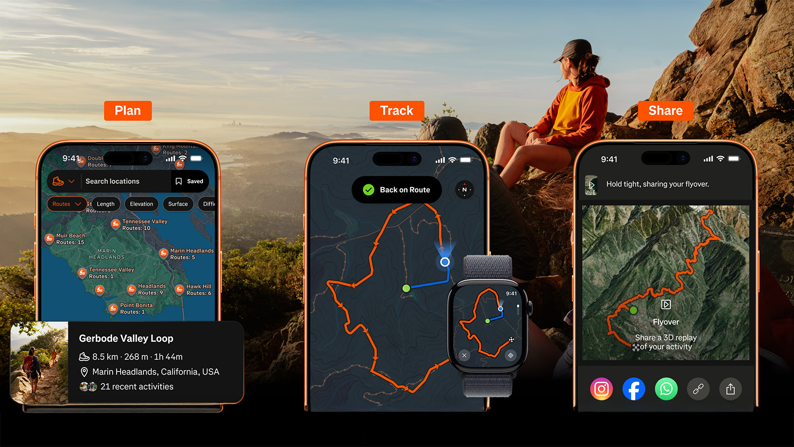
Subscribers also get access to Route Discovery, which surfaces popular routes in a chosen area using Strava’s global heatmap data, and Route Builder, which lets users plan custom hikes with live distance, elevation and surface information as they draw.
There’s also a new Route Saves feature that allows subscribers to save routes from different parts of the app and access them directly in Strava.
Your wrist is becoming the trail guide
Off-Route Alerts are another new feature for subscribers that notify you when you stray from a planned route.
The app already supports route following on Apple Watch, while Smart Watch Route Sync allows Strava routes to be sent to compatible Apple, Coros and Garmin watches.
Offline Routes are also available to subscribers, providing access to downloaded routes in areas with poor or no signal.
Other on-the-trail additions include a full-screen Mobile Record Map and Live Elevation, which show elevation profile data during an activity.
Finally, Strava is leaning into the social side of hiking with 3D Activity Maps, Activity Replays, sticker stats, hiking clubs and Flyover, a cinematic 3D aerial animation of a completed route.
Most of the features are available now, with the improved map style arriving later this summer.
Head over to Strava to learn more about the new hiking features.