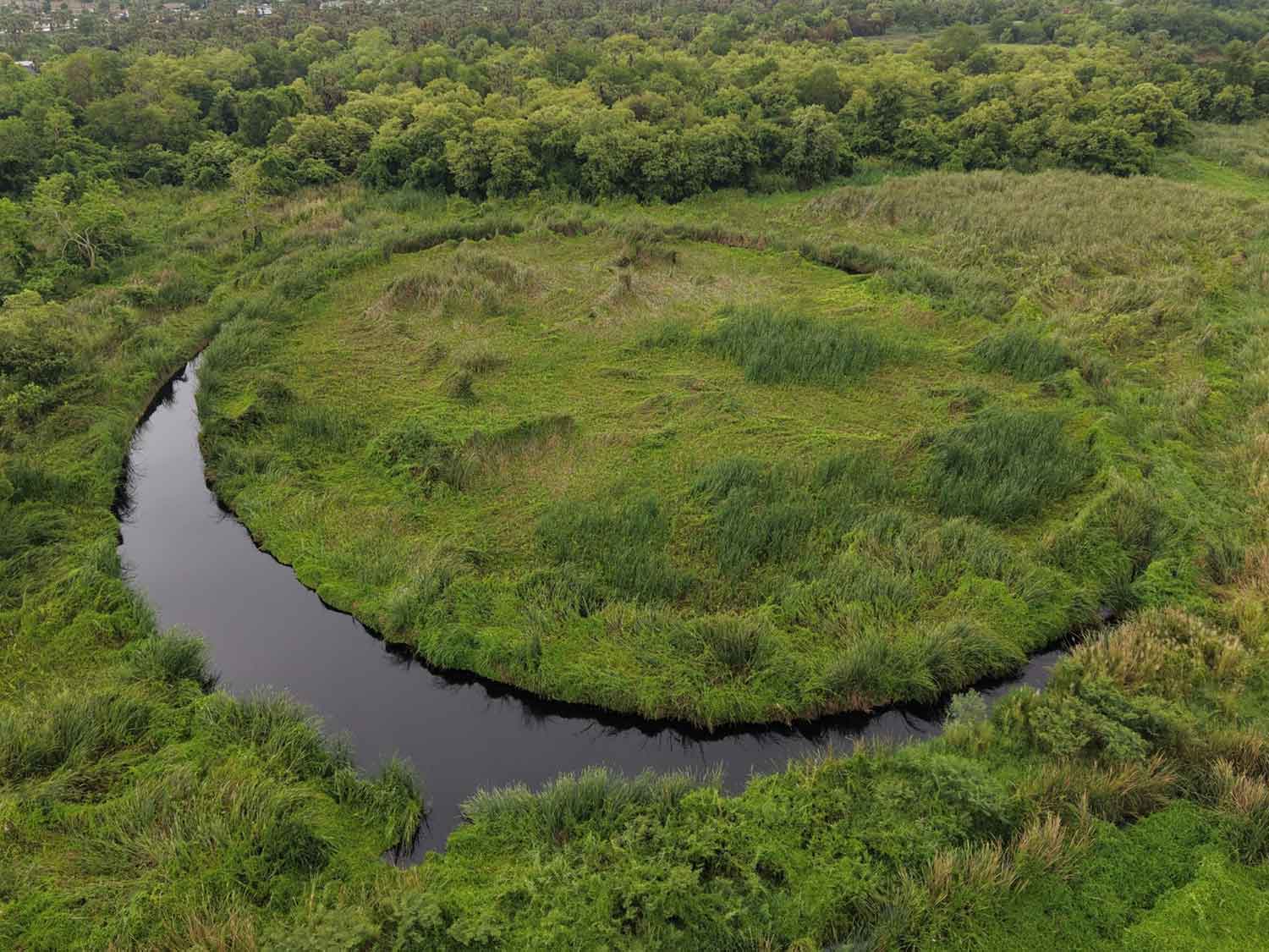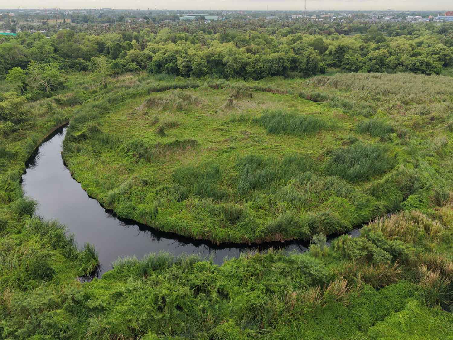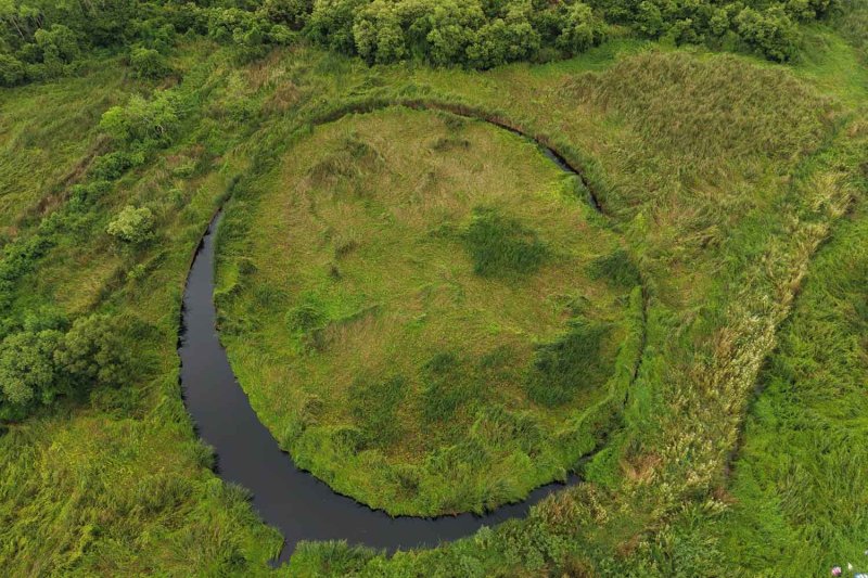
Local authorities and experts have conducted a drone survey of a mysterious circular island known as "The Eye" in Pathum Thani after images of the site went viral on social media, prompting discussion about its potential as a tourist attraction.
Interest surged after Prinya Thaewanarumitkul, a law professor and director of the Legal Studies Centre at Thammasat University, posted striking aerial footage of the formation on his Facebook page.
Mr Prinya suggested the phenomenon may have formed naturally following the devastating 2011 floods. He described it as a floating mass of aquatic vegetation that slowly rotates and rubs against the shoreline, gradually forming a nearly perfect circle resembling Argentina's famous floating island, El Ojo.
Following the online attention, local officials and community leaders inspected the site, which sits on privately owned land belonging to Siriphon Wattana 1979 Co.
Drone footage revealed the pond covers more than 12 rai. Investigators found that the circular formation consists largely of floating vegetation moving with wind currents within the water body.
Village headman Preecha Poondee of tambon Suan Prik Thai said the pond has existed for as long as he can remember, explaining the area was created decades ago through soil excavation for commercial purposes.
"From ground level, there is nothing particularly unusual about it," he said. "But from above, it looks extraordinary and could be considered an unseen attraction."
Chaiwat Inlert later visited the site on behalf of the Pathum Thani Provincial Administrative Organisation (PAO). He said PAO President Kamronwit Thoopkrajang had ordered engineers to inspect the area and determine its characteristics.
On the eastern side of the Chao Phraya River, about two kilometres southeast of Pathum Thani Bridge 1, the circular island measures roughly 100-120 metres in diameter. Authorities are now coordinating with the landowner to explore whether the site could be opened to visitors.
Meanwhile, Jessada Denduangboripant, a science lecturer at Chulalongkorn University, offered a more conventional explanation. In a social-media fact-check post, Mr Jessada said historical satellite imagery suggests the site is likely a large pond or wetland where aquatic plants, including reeds and water hyacinths, have spread across the surface, forming the unusual pattern over time.